Foreign cruisers considering coming to Japan are often surprised, and sometimes deterred, by the lack of English-language information. There are no cruising guides (although yours truly is making sporadic progress on writing one), and the blogs written by cruisers often have very outdated and incorrect information. So with that in mind, this edition of “Kirk’s Take” focuses on how to get reliable information for cruising Japan.
Noonsite
Of course, the first stop for cruisers planning to visit a new country is the excellent website Noonsite. The Japan section is very good, and I provide occasional updates to the Noonsite editor to help ensure the information is accurate. The country is too big and there are too many moorage options for Noonsite to provide comprehensive information, but it’s a great place to start.
Digital Charts
The Japan charts in CMAP and Navionics are good but not great (CMAP is the better of the two). I did my three-year Japan circumnavigation using CMAP and I managed, but I relied a lot on other printed materials and online information. The main problem of both products is that they provide inadequate detail on Japan’s small fishing ports, which is where cruisers most commonly moor. In addition, they do not display the location of Japan’s numerous fixed fishing nets and the (accurate) heights of many bridges and power lines, and if one doesn’t make a point of updating them regularly the information gets old quickly.
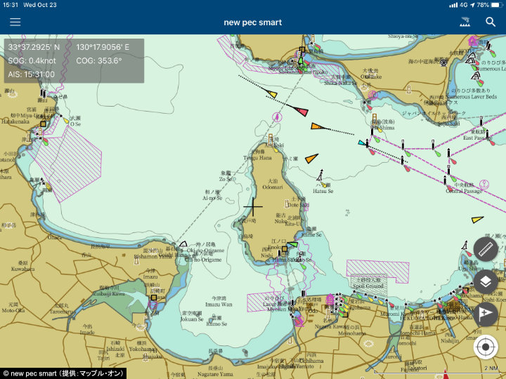
I therefore strongly recommend that cruisers use new pec, the Japan Hydrographic Association’s digital charting software, and specifically new pec smart, the version for tablets and smart phones (both Apple and Android). In addition to providing very detailed, accurate, and regularly updated information on fishing ports, marinas, and other harbors, new pec displays the location of fixed fishing nets, the heights of bridges and power lines, current and tide information, nearby AIS targets (new pec smart only), and much more. With new pec, one doesn’t really need much else. New pec is only in Japanese, but it is very intuitive and easy to use, especially for its basic functions, so a Japanese-reading friend can get you up and running on it in about an hour, or Konpira Consulting provides a tutorial and ongoing support.
Read the “Kirk’s Take” column on new pec for more information.
Japan Hydrographic Association
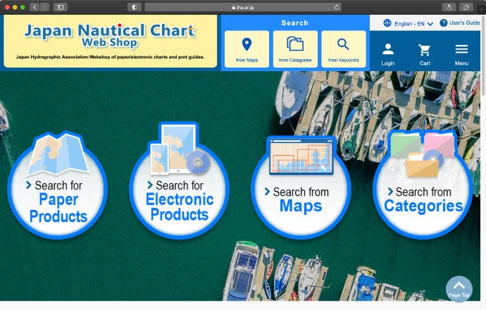
For those that don’t have new pec smart, I recommend that they go to the Web Shop of the Japan Hydrographic Association (JHA).
There you can buy:
- Small-scale and large-scale charts for the entire country;
- Charts showing the location of fixed fishing nets in each region – essential if you don’t have new pec (running into a net, unmarked at night, can cost ¥300,000 [$2,900] or more and require a week or two in port for “investigation”);
- Y (Yachting) Charts – user-friendly charts for the most popular cruising areas;
- Sailing Directions – five regional volumes to cover all of Japan;
- Digital versions of the S Guides – the S Guides (12 volumes) are collections of chartlets for virtually all of Japan’s ports and so are invaluable reference tools for cruisers, but JHA now only sells digital versions, which one downloads and then prints out (if you can find used hard copies, buy them!); most of the S Guide information is in new pec, but the guides are nevertheless very handy if one expects to be cruising Japan or a certain region for a long time (it’s probably not worth the cost for cruisers just passing through fairly quickly);
- A very detailed Tide Tables book, which also includes Tidal Currents tables (for both primary and secondary stations) – it’s primarily in Japanese, but with enough English information to be able to figure it out; again, very worthwhile for those cruising Japan for a long time (especially Kyushu and the Seto Inland Sea, which have straits with very strong currents), but not so much for others.
Online Information
There are many websites that provide useful information for cruisers, including the following:
- Seto Inland Sea
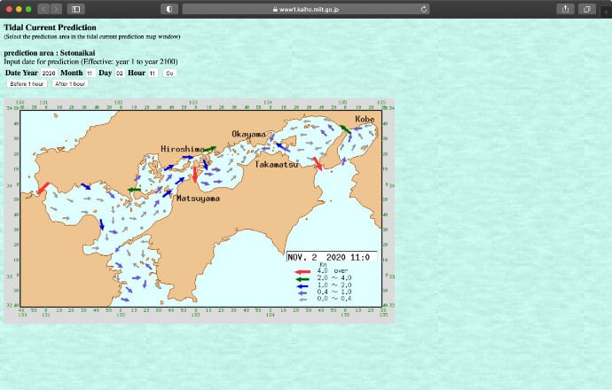
This website provides useful information for those cruising the Seto Inland Sea. - Tidal Currents
Although not as comprehensive and precise as the Tide Tables book noted above, this website provides graphic representation of the strength and direction of tidal currents for most of Japan. - Umi no Eki
Most (but not all) marinas and other facilities that have moorage for visiting boats are registered as Umi no Eki (Sea Stations), and information on them can be found at this website. - Weather Forecasts
Far and away the best source for weather forecasts in Japan is GPV. It is, unfortunately, only in Japanese, but a Japanese friend can help you figure it out in less than an hour or Konpira Consulting offers a start-up tutorial and ongoing support.
With the above information at hand, cruisers will find Japan an easy place to explore and enjoy. And, once here, they will get plugged into the network of Japanese and foreign cruisers – it’s a friendly community that is always willing to provide advice on where to moor and what to see, as well as introductions to mechanics and haul-out facilities.
To learn how Konpira Yacht Services can help you enjoy the wonders of Japan's oceans, please feel free to contact us for more information.